Technology has long become part of people’s everyday lives. There is no doubt; technology has been providing us multiple advantages until today. No one can ignore the impact it has given to the world for hundreds of years. Technology has made our lives easier and professionals are still developing more to make every living more convenient.
The 21st century is also known as the era of technology. It’s quite fascinating how these technologies are made to make life easier in just a click away! What seems to be unbelievable are made possible through technology. This is probably the perfect time we look back and appreciate that technology has played a significant role in improving human life.
This may be your first time hearing about LiDAR. As there is continuously rapid growth and development of technologies, some may seem unfamiliar to us. Read more to know and learn more about LiDAR and what are its uses.
LiDAR
LiDAR means light detection and ranging. This technology is used to measure the distance of an object on the surface of the earth. Although some people might be new to the concept of this tech, LiDar first came into use in the early 60’s.
The distance is determined by transmitting a laser beam commonly from airplanes. Finally, in the 1980s, accurate lidar data was made possible through the arrival of a commercial Global Positioning System (GPS) and inertial measurement units (IMUs).
LiDAR is a popular remote sensing method. This tech provides and generates precise ad three-dimensional information about the earth’s surface and characteristics. This feature is made possible by combining light pulses and other data recorded in the airborne system.
Types of LiDAR
A LiDAR is primarily composed of a laser, a scanner, and a specialized GPS receiver. Just like before, airplanes and helicopters are the platforms commonly used to achieve LiDAR data. This is mostly useful especially over broad areas. Furthermore, the data that people get from the photodetector and optics are also vital elements in the data collection process.
There is lidar for sale that is affordable, accurate, and easy to use. Blending durability and simplicity create an effective system that can produce accurate and reliable data. Two types of LiDAR exist and are used according to their functionality. These two types are Airborne LiDAR and Terrestrial LiDAR. Here we provide more info about these two types of LiDAR.
Airborne LiDAR
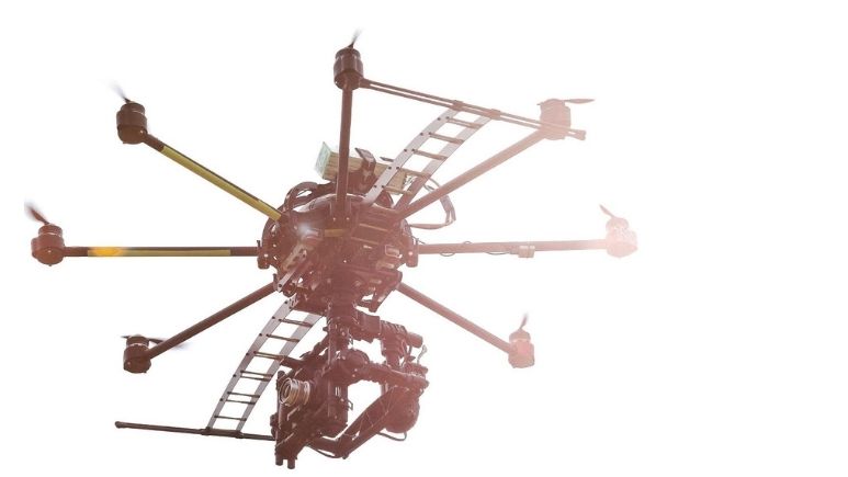
Airborne LiDAR is used and is installed in helicopters or drones. Airborne LiDARs are also known as airborne laser scanning or ALS. This technology is useful in area-wide 3D data acquisition. This is most especially helpful in the data gathering of topography, vegetation, bathymetry, building, and infrastructure on the earth’s surface.
How does it work? After activating the airborne lidar, it will then proceed to emit lights towards the ground. This light will immediately return to the sensors after hitting an object’s surface. As a result, it will produce accurate and exact measurements of its distance. Also, there are two types of Airborne LiDAR:
- Airborne LiDAR Bathymetry – It works using green spectrum laser beams. Data acquisition involves seafloor mapping and ground truth components. It further includes video transect and sampling.
- Airborne Topographic LiDAR – It uses a near-infrared laser to map the land surface. It can derive surface models for forestry, hydrology, geomorphology, coastal engineering, volumetric calculations, etc.
Terrestrial LiDAR
Unlike airborne lidar, terrestrial lidar can be used on the earth’s surface. Its application can either be stationary or mobile. The system can also be installed in tripods to collect data points accurately. The terrestrial lidar is commonly used to observe highways or analyze infrastructures.
- Stationary Terrestrial Scanning – This is commonly used for survey methods like conventional topography, cultural heritage, documentation, monitoring, and even forensics. Compared to other forms of LiDAR, this tech can create realistic 3D models quickly.
- Mobile Laser Scanning – Two or more scanners are commonly attached to a moving vehicle. This technology is effective in collecting data along the path. It can be a reliable tool that produces undeniably accurate measurements needed.
Applications
As mentioned above, there are different types and subtypes of lidar. Thus, it is given that lidar also has a variety of applications. We may be unaware, but lidar provides a lot of help in our everyday lives. Listed below are the determined application of lidar:
- Agriculture – Agricultural robots are used for seed and fertilizer dispersions. 3D lidar is also helpful in identifying plant species.
- Archeology – Lidars are useful in planning field campaigns, mapping features, and providing an overview of broad and continuous land features.
- Vehicles – Lidars are used for obstacle detection and navigation, which promotes a safe driving environment.
- Biology – Airborne lidars are helpful in leaf area, biomass measurement, and canopy heights.
- Other lidar applications include geology, atmosphere, law enforcement, physics, astronomy, and many more.
Takeaway
LiDAR may seem unfamiliar to many, but it is indeed one of the most helpful technologies globally. Not only because of its great scope but also its ability to be applied in many important areas in human life and the environment. Thus, we must give importance to these technologies as it helps us achieve the unreachable things around us.